【往期回顾】
【本期内容】
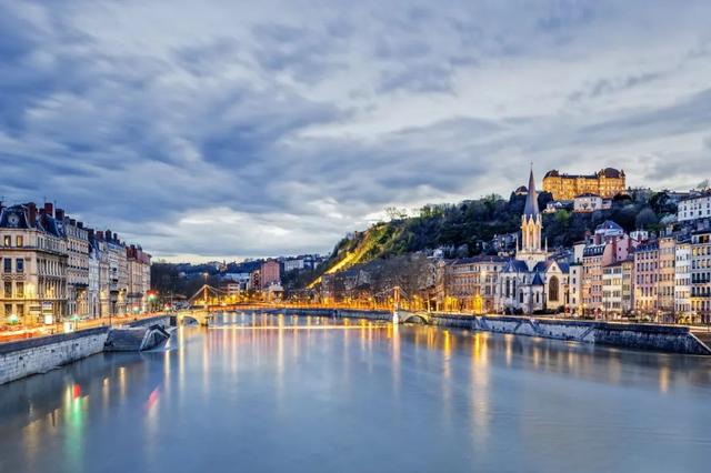
The Seine River
塞纳河

Seine River, river of France, after the Loire its longest. It rises 18 miles (30 kilometres) northwest of Dijon and flows in a northwesterly direction through Paris before emptying into the English Channel at Le Havre. The river is 485 miles (780 kilometres) long and with its tributaries drains an area of about 30,400 square miles (78,700 square kilometres). It is one of Europe’s great historic rivers, and its drainage network carries most of the French inland waterway traffic. Since the early Middle Ages it has been above all the river of Paris, and the mutual interdependence of the river and the city that was established at its major crossing points has been indissolubly forged. The fertile centre of its basin in the Île-de-France was the cradle of the French monarchy and the nucleus of the expanding nation-state and is still its heartland and metropolitan region.
塞纳河,法国的河流,是继卢瓦尔河之后最长的河流。它发源于第戎西北18英里(30公里)处,向西北方向流经巴黎,然后在勒阿弗尔汇入英吉利海峡。这条河长485英里(780公里),其支流流域面积约为30400平方英里(78700平方公里)。它是欧洲历史上最伟大的河流之一,其排水网络承载了法国内陆水道的大部分交通。自中世纪早期以来,它首先是巴黎河,这条河和在其主要过境点建立的城市之间的相互依存关系是不可分割的。法兰西岛盆地肥沃的中心是法国君主制的摇篮和不断扩张的民族国家的核心,现在仍然是其中心地带和大都市区。
Physiography
地文特征
The Seine rises at 1,545 feet (471 metres) above sea level on the Mont Tasselot in the Côte d’Or region of Burgundy but is still only a small stream when it traverses porous limestone country beyond Châtillon. Flowing northwest from Burgundy, it enters Champagne above Troyes and traverses the dry chalk plateau of Champagne in a well-defined trench. Joined by the Aube near Romilly, the river bears west to skirt the Île-de-France in a wide valley to Montereau, where it receives the Yonne on its left bank. This tributary is exceptional in rising beyond the sedimentary rocks of the Paris Basin on the impermeable crystalline highland of the Morvan, a northward extension of the Massif Central. Turning northwest again, the Seine passes Melun and Corbeil as its trenched valley crosses the Île-de-France toward Paris. As it enters Paris, it is joined by its great tributary the Marne on the right, and, after traversing the metropolis, it receives the Oise, also on the right. In its passage through Paris, the river has been trained and narrowed between riverside quays. Flowing sluggishly in sweeping loops, the Seine passes below Mantes-la-Jolie across Normandy toward its estuary in the English Channel. The broad estuary opens rapidly and extends for 16 miles below Tancarville to Le Havre; it experiences the phenomenon of the tidal bore, which is known as the mascaret, although continued dredging since 1867 has deepened the river so that the mascaret has gradually diminished.
塞纳河在勃艮第的科多尔地区的塔塞洛山上海拔1545英尺(471米),但当它穿过沙蒂隆以外的多孔石灰岩国家时,它仍然只是一条小溪。它从勃艮第向西北流动,在特鲁瓦上方进入香槟,在一条轮廓分明的沟渠中穿过香槟的干燥白垩高原。这条河在罗米利附近与奥布河汇合,向西绕过法兰西岛,形成一个宽阔的山谷,到达蒙特罗,在那里它在左岸接收扬河。这条支流在莫尔旺不透水的结晶高地上,从巴黎盆地的沉积岩中升起,这是中央地块向北延伸的一部分,这一点很特殊。塞纳河再次转向西北,经过梅伦和科贝伊,其挖沟山谷穿过法兰西岛向巴黎延伸。当它进入巴黎时,它在右边与它的伟大支流马恩河汇合,穿过大都市后,它在左边与瓦兹河汇合。在流经巴黎的过程中,这条河在河岸码头之间被整治并变窄。塞纳河缓慢地绕圈流动,从曼特斯拉朱莉河下游穿过诺曼底,流向英吉利海峡的河口。宽阔的河口迅速打开,在坦卡维尔以下延伸16英里至勒阿弗尔;尽管自1867年以来持续的疏浚加深了河流,使马斯卡雷特河逐渐减少,但它经历了被称为马斯卡雷特的涌潮现象。
From its source to Paris, the Seine traverses concentric belts of successively younger sedimentary rocks, infilling a structural basin, the centre of which is occupied by the limestone platforms of the Île-de-France immediately surrounding Paris. The rocks of this basin are inclined gently toward Paris at the centre and present a series of outward-facing limestone (including chalk) escarpments (côtes) alternating with narrower clay vales. The côtes are breached by the Seine and its tributaries, which have made prominent gaps. As they converge upon Paris, the trenchlike river valleys separate a number of islandlike limestone platforms covered with fertile, easily worked windblown soil (limon). These platforms have provided rich cereal-growing land from time immemorial and constitute the Île-de-France. The lower course of the Seine, below Paris, is directed in a general northwesterly direction toward the sea, in conformity with the trend of the lines of structural weakness affecting the northern part of the basin. The English Channel breaches the symmetry of the basin on its northern side, interrupting the completeness of the concentric zones. Still in the chalk belt, the river enters the sea. The basin of the Seine presents no striking relief contrasts. Within 30 miles of its source the river is already below 800 feet, and at Paris, 227 miles from its mouth, it is only 80 feet above sea level. It is thus slow flowing and eminently navigable, the more so because its regime is generally so regular.
塞纳河从源头到巴黎,穿过连续较新的沉积岩同心带,填充了一个构造盆地,其中心被紧邻巴黎的法兰西岛石灰岩台地所占据。该盆地的岩石在中心缓缓向巴黎倾斜,呈现出一系列向外的石灰岩(包括白垩)悬崖(côtes),与较窄的粘土谷交替出现。塞纳河及其支流冲破了这些河道,形成了明显的缺口。当它们汇聚在巴黎时,沟渠般的河谷将许多岛屿般的石灰岩平台隔开,这些平台上覆盖着肥沃、易于耕作的风积土壤(limon)。这些平台自古以来就提供了丰富的谷物种植地,构成了法兰西岛。塞纳河下游在巴黎以下,总体上向西北方向朝向大海,与影响盆地北部的构造弱点线的趋势一致。英吉利海峡破坏了盆地北侧的对称性,破坏了同心带的完整性。河流仍在白垩带,汇入大海。塞纳河流域没有明显的地形对比。在距离源头30英里的范围内,这条河已经低于800英尺,而在距离河口227英里的巴黎,它只高出海平面80英尺。因此,它的流速很慢,非常适合航行,尤其是因为它的制度通常很有规律。

Hydrology
水文特征
Most of the river basin is formed of permeable rocks, the absorptive capacity of which mitigates the risk of river floods. Precipitation throughout the basin is modest, generally 25 to 30 inches (650 to 750 millimetres), and is evenly distributed over the year as rain, with snow infrequent except on the higher southern and eastern margins. The Yonne—unique among the tributaries in being derived from impermeable, crystalline highlands, where there is also considerable winter snow—also has the greatest influence on the Seine’s regime (flow) because of the great variability of its flow; but the Seine is the most regular of the major rivers of France and the most naturally navigable. Occasionally the summer level is considerably reduced (such as in the summers of 1947 and 1949), but the sandbanks that are so typical of the Loire do not appear. Low water is further masked by the regularization of the river that has been carried out to improve its navigability. Winter floods are rarely dangerous, but in January 1910 exceptionally heavy rainfall caused the river to rise above 28 feet at Paris, flooding the extensive low-lying quarters along its ancient meander loop (the Marais). To match this high level it is necessary to go back to February 1658; but in January 1924 and also in January 1955 the river again rose to more than 23 feet in Paris. The average flow at Paris is about 10,000 cubic feet (280 cubic metres) per second, as compared with the 1910 flood rate of about 83,000 and the 1947 and 1949 minimums of about 700.
流域的大部分由渗透性岩石组成,其吸收能力减轻了河流洪水的风险。整个流域的降水量适中,一般为25至30英寸(650至750毫米),全年降雨均匀分布,除南部和东部边缘较高外,很少下雪。约讷河在支流中是独一无二的,因为它来自不透水的水晶高地,那里也有相当多的冬季积雪,由于其流量的巨大变化,对塞纳河的流量也有最大的影响;但塞纳河是法国最规则的主要河流,也是最自然通航的河流。夏季水位偶尔会大幅下降(如1947年和1949年的夏季),但卢瓦尔河特有的沙洲不会出现。为提高河流的通航能力而进行的河流整治进一步掩盖了低水位。冬季洪水很少是危险的,但在1910年1月,异常强的降雨导致巴黎的河水上涨了28英尺以上,淹没了其古老蜿蜒环路(Marais)沿线广大的低洼地区。为了达到这一高水平,有必要追溯到1658年2月;但在1924年1月和1955年1月,巴黎的河水再次上涨至23英尺以上。巴黎的平均流量约为每秒10000立方英尺(280立方米),而1910年的洪水率约为83000,1947年和1949年的最低洪水率约700。

The economy
经济地位
The Seine, especially below Paris, is a great traffic highway. It links Paris with the sea and the huge maritime port of Le Havre. Rouen, although some 75 miles from the sea, was France’s main seaport in the 16th century, but it was surpassed by Le Havre in the 19th century. Vessels drawing up to 10 feet (3.2 metres) can reach the quays of Paris. Most of the traffic, which chiefly consists of heavy petroleum products and building materials, passes upstream to the main facilities of the port of Paris at Gennevilliers. The lower Seine system is connected with that of the Rhine by way of the Marne, and the Oise links it with the waterways of Belgium. The links with the Loire waterway and with the Saône-Rhône, dating from the 17th and 18th centuries when connecting canals were built, are now of minor importance. The water of the Seine is an important resource for the riverine population. Large electric power stations, both thermal and nuclear, draw their cooling water from the river. In addition, half of the water used in the region around Paris, both for industry and for human consumption, and three-fourths of the water used in the region between Rouen and Le Havre, is taken from the river.
塞纳河,尤其是巴黎以下的塞纳河,是一条交通便利的高速公路。它将巴黎与大海和巨大的海港勒阿弗尔连接起来。鲁昂虽然距离大海约75英里,但在16世纪是法国的主要海港,但在19世纪被勒阿弗尔超越。长达10英尺(3.2米)的船只可以到达巴黎的码头。大部分交通主要由重质石油产品和建筑材料组成,向上游通过巴黎港热讷维耶的主要设施。塞纳河下游通过马恩河与莱茵河相连,瓦兹河将其与比利时的水道相连。与卢瓦尔河水道和索恩-罗讷河的联系可以追溯到17世纪和18世纪,当时修建了连接运河,现在已经不那么重要了。塞纳河的水是河岸人口的重要资源。大型火力发电站和核电站都从河里取水。此外,巴黎周边地区一半的工业用水和人类用水,以及鲁昂和勒阿弗尔之间地区四分之三的用水都来自河流。

Development of the river
河流的开发
Although the regime of the Seine is relatively moderate, improvements have been considered necessary since the beginning of the 19th century. To improve navigation, the water level was raised by means of dams and by storage reservoirs in the basin of the Yonne River. Lake Settons (1858), originally designed for the flotation of wood, and Crescent (1932) and Chaumeçon (1934) reservoirs have proved useful in reducing floods as well as in ensuring a constant water supply in summer. Upstream from the basin four large storage reservoirs have been built since 1950 on the Yonne, Marne, and Aube, as well as on the Seine itself. These relatively shallow impoundments (averaging about 25 feet in depth) cover large areas. The Seine Reservoir, for example, covers some 6,175 acres (2,500 hectares), while the Marne Reservoir, with an area of about 11,900 acres, is the largest artificial lake in western Europe. Surrounded by woodland and countryside, these reservoirs have become bird sanctuaries and tourist attractions in a new nature reserve.
虽然塞纳河的管理相对温和,但自19世纪初以来,人们认为有必要进行改进。为了改善航运,通过在约讷河流域修建水坝和蓄水池来提高水位。塞顿湖(1858年)最初是为漂浮木材而设计的,新月(1932年)和肖梅松(1934年)水库已被证明在减少洪水和确保夏季持续供水方面非常有用。自1950年以来,在盆地上游的约讷、马恩和奥布以及塞纳河上建造了四座大型蓄水池。这些相对较浅的蓄水池(平均深度约25英尺)覆盖了大片地区。例如,塞纳河水库占地约6175英亩(2500公顷),而马恩水库占地约11900英亩,是西欧最大的人工湖。这些水库被林地和乡村环绕,已成为新自然保护区的鸟类保护区和旅游景点。

【Source】www.britannica.com
【Translated by】Spark Liao (廖怀宝)
【Illustration】From Bing